


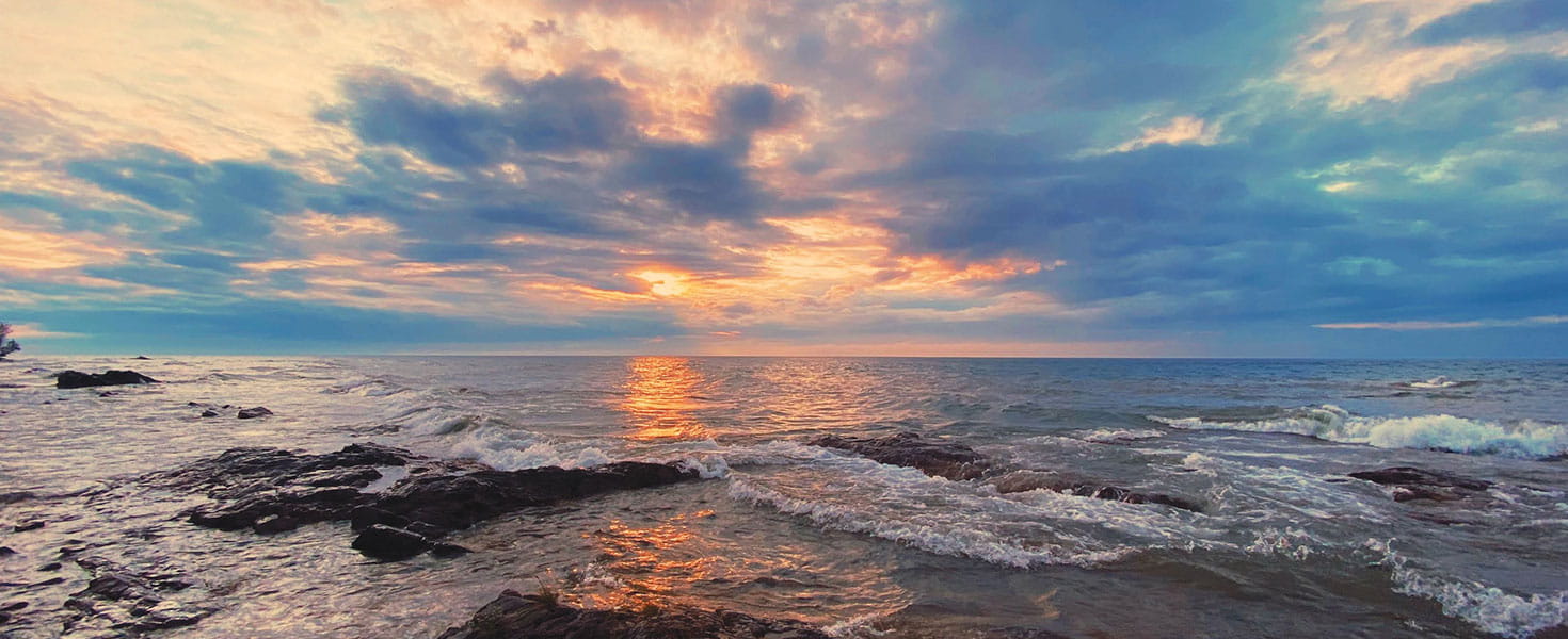

In Michigan’s Upper Peninsula, life revolves around Lake Superior. At 31,700 square miles, it’s the world’s largest freshwater lake by area.
In the region nicknamed the UP, thick forests of sugar maples, nodding white trilliums and red thimbleberries thrive thanks to rain and heavy lake-effect snowfall. Whitefish and lake trout emerge from its depths to challenge anglers and fill restaurant menus. Towering lighthouses, agate-strewn beaches and the steady roll of whitecaps lure photographers.
These landscapes spool out on a drive across northernmost Michigan. The route begins in the 350-year-old French settlement of Sault Ste. Marie, following I-75 briefly before veering onto M-28. Detours along M-123 and US-41 lead to must-see sights like Whitefish Point and Copper Harbor before ending in Porcupine Mountains Wilderness State Park near the Wisconsin border. All told, it’s a 500-mile journey of shipwreck lore and ice-cold streams, hiking trails carpeted with pine needles and unparalleled stargazing.
But Lake Superior is seldom far from view—and never far from mind.
FRENCH SETTLERS AND FREIGHTERS
Start your road trip in Michigan’s oldest city, Sault Ste. Marie, settled by French colonists in 1668 and located on Lake Superior’s easternmost end. Here, the lake narrows into St. Marys River and forms a natural meeting place for people, goods and sailing vessels.
80 million tons of freight through them annually.
Ships passing through the Soo Locks sail through Lake Superior’s ominously christened Shipwreck Alley. Located some 50 miles northwest of Sault Ste. Marie, the treacherous passage marks the final resting place of at least 200 shipwrecks.
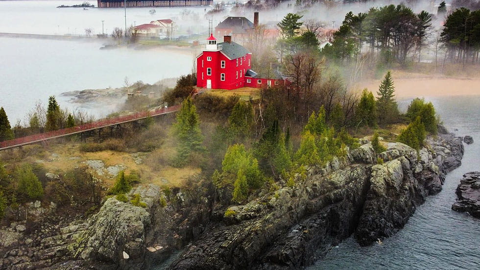
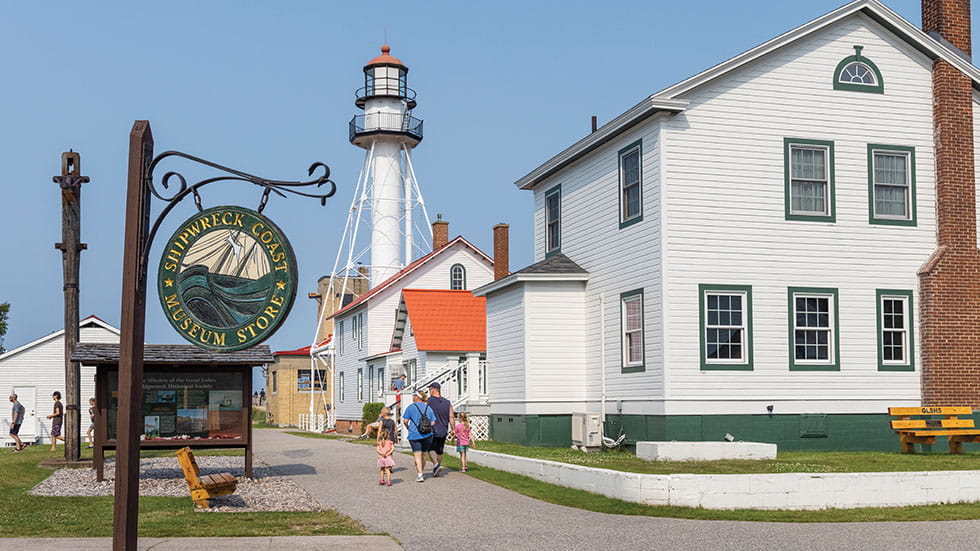
The Great Lakes Shipwreck Museum at Whitefish Point pays homage to these ships, recounting tales of their demise and displaying salvaged artifacts. Prominent in the collection is the bell from the 1975 wreck of the SS Edmund Fitzgerald, Shipwreck Alley’s most famous casualty. The adjacent Coast Guard buildings and the oldest active lighthouse tower on Lake Superior spotlight the heroic efforts employed by lifesavers who battled the surf to rescue survivors.
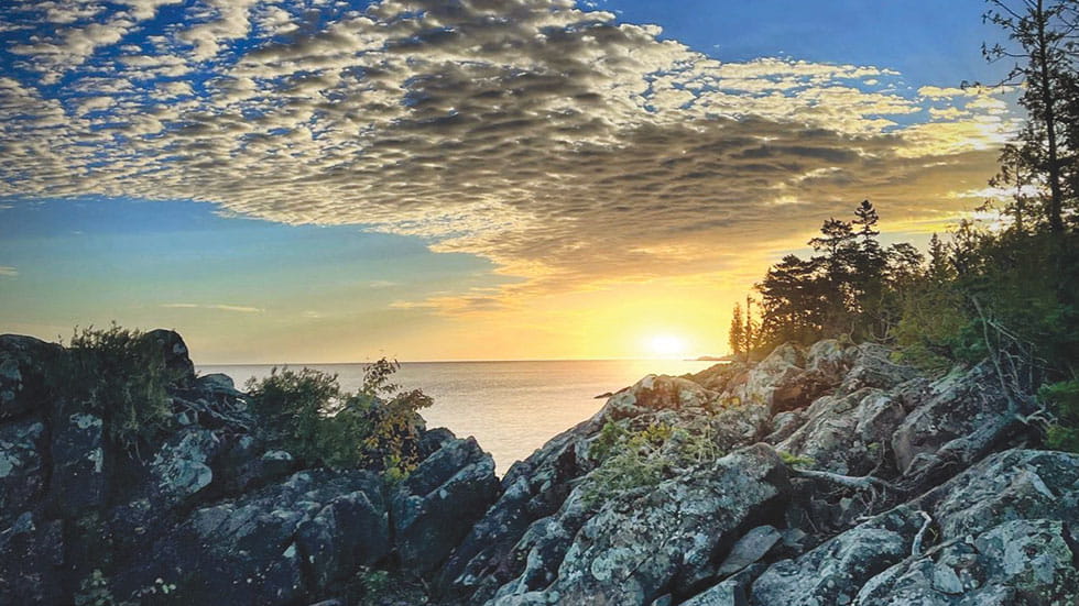 Keweenaw Peninsula. Photo Courtesy of Up Travel
ROCKY BEACHES AND COPPER COUNTRY
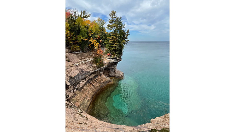
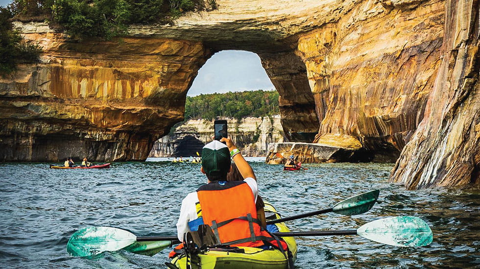
With its russet- and orange-colored cliffs, intricately carved rock pillars, freshwater caves and sparkling 140-foot waterfalls, Pictured Rocks National Lakeshore is a heavily visited stretch of Lake Superior shoreline. Located near Munising just off M-28, the national park includes nearly 100 miles of hiking trails that snake through dense maple and birch forests, past Lake Superior beaches and through rocky gorges. But the only way to view the rocky coast as a whole is from the water. Pictured Rocks Cruises sails past the most spectacular of the multicolored cliffs and waterfalls, including Miners Castle and Bridalveil Falls.
 Great Lakes Shipwreck Museum. Photo Courtesy of Up Travel
Farther west along M-28, the city of Marquette is dominated by its own Lake Superior landmark: the Lower Harbor Ore Dock. Measuring 85 feet high and nearly 1,000 feet long, the dock once allowed trains to funnel their cargo onto waiting Lake Superior freighters. Decommissioned in 1971, the dock continues to remind passersby of Marquette’s rich iron ore history and serves as something of an art piece and a backdrop for laser light shows on select days year-round. Mining history runs deep throughout Marquette and the Keweenaw Peninsula. The Keweenaw National Historical Park details the local mining legacy of what’s come to be known as “Copper Country,” a history begun 7,000 years ago by Native inhabitants who first mined the copper. During its heyday around the turn of the 20th century, some 100 mines were active. Among the park’s two dozen attractions, highlights include the Coppertown Mining Museum and a two-hour tour of the abandoned (and very damp) Quincy Mine, where visitors can get a sense of the hardships borne by miners.
 Pictured Rocks National Lakeshore. Photo Courtesy of Up Travel
WANDER THROUGH THE WILDERNESS
Mining heritage adds a historical layer to a Lake Superior road trip, but outdoor recreation ranks as the Keweenaw’s chief draw. In the little town of Copper Harbor, glassy inlets provide Lake Superior paddling opportunities, and the town’s rocky surroundings are crisscrossed with mountain biking trails. Copper Harbor’s ferry dock serves Isle Royale National Park, one of the country’s most remote and less-visited national parks.
The Porcupine Mountains promise additional wilderness exploration in the westernmost reaches of the UP, thanks to the sparkling Lake of the Clouds, gushing waterfalls and backpacking treks deep into some of Michigan’s most isolated wilderness. But the Porkies, as they’re known locally, captivate less intrepid visitors along the Presque Isle River. The West River Trail parallels the river, leading day hikers over natural staircases of basalt and exposed, twisted tree roots. A trio of waterfalls and quiet pools draws photographers, bathing suit-clad youngsters, and children eager to scoop up tadpoles and minnows with cupped hands.
The official route of the West River Trail culminates at a wooden suspension bridge over the Presque Isle River, returning visitors to the trailhead by way of the East River Trail. But most visitors choose to continue on, forging their way farther north along the riverbank, where the Presque Isle River empties into what locals call the Big Lake.
Here at the road’s end, it’s hard to say good-bye. And even harder to resist the pull of Lake Superior, still wild in the West.