


The U.S. East Coast boasts some spectacular oceanside driving routes. Far to the north, U.S. Route 1 follows the rugged Maine coast from its down-east border with Canada to its southeast beaches near the New Hampshire border. The southernmost section of that same highway dazzles with aquamarine waters on both sides of the Overseas Highway as it cuts through the Florida Keys.
And right about midpoint on the coast, the Delmarva Peninsula offers up its own scenic coastal route starting in Lewes, Delaware—where the Delaware Bay meets the Atlantic Ocean—and continuing south to the tip of Virginia’s Eastern Shore—where the ocean meets the Chesapeake Bay.
The distance logged from point to point on this road trip is only about 150 miles, but we recommend spreading out the journey over at least a few days. You’ll want plenty of time to explore the region’s bustling beach towns (including two with boardwalks routinely ranked among the top in the country) and quiet communities as well as its state parks and national wildlife refuges.
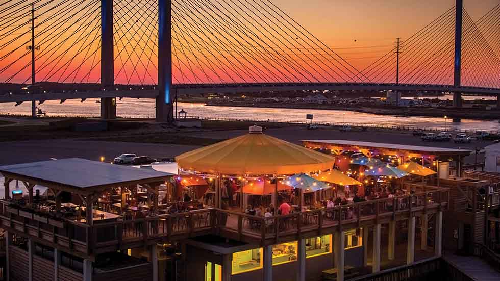
Meals and drinks at Big Chill Beach Club in Delaware. Seashore State Park are served up with a view. Courtesy of visitsoutherndelaware.com
DELAWARE: THE FIRST STATE
Settled in 1631 and known as the First Town in the First State, Lewes (pronounced Lew-is) charms with a downtown comprising several blocks of shops and restaurants. The history buff in you will enjoy touring the numerous properties run by the Lewes Historical Society, including nine buildings at its Shipcarpenter Street Campus.
But the prime attraction in Lewes is Cape Henlopen State Park, a spit of land bordered by the Delaware Bay and the Atlantic Ocean—and the point that marks the beginning of Delaware’s Atlantic coastline. Visitors to the 5,100-acre park enjoy biking and hiking on its varied trails, sunning and swimming at its beaches, and exploring Fort Miles Museum and Historical Area, which preserves and interprets a former military base that had been vital to coastal defense from World War II through the early 1970s.
Back in downtown Lewes, splurge on dinner at Heirloom, where Chef Matthew Kern, a 2020 James Beard Award Semifinalist, dishes up elegant fare in dining areas scattered throughout a stylish Victorian home.
To leave Lewes, take Route 9 West, and turn south onto Delaware Route 1 (not to be confused with U.S. 1) to continue exploring the state’s seaside highlights. Depending on the season and day of the week, the next few miles, lined by strip malls and outlet centers, could be bumper-to-bumper traffic or a relatively easy ride. Regardless, Rehoboth enthusiasts will tell you the inconvenience is worth it.
Detour off Route 1 onto Rehoboth Avenue Extended to reach downtown Rehoboth Beach with its abundance of boutiques, restaurants, hotels, and rental properties. A seaside resort since the late 19th century, Rehoboth is beloved by families as well as the LGBTQ community that helped build the town that today buzzes with activity nearly year-round.

Fresh local blueberry ice cream at Island Creamery in Chincoteague. Photo credit Island Creamery
The main drag, Rehoboth Avenue, stretches for six lively blocks before ending in a T at the boardwalk, where the iconic large Dolles sign sits atop a store that’s been selling handmade taffy and fudge since 1927. The mile-long wooden boardwalk is flanked on one side by the usual assortment of hotels, souvenir shops, and purveyors of French fries, pizza and ice cream, and on the other by the city’s beach, which extends for an additional half-mile beyond. Funland, near the boardwalk’s southern end, is a small covered amusement park that has been run by the Fastnacht family for 58 years.
If you’re a lover of microbrews, you know Rehoboth Beach as the birthplace in 1995 of Dogfish Head beer. Sam Calagione’s brewery has since moved west to Milton, but you can still raise a glass at Dogfish Head Brewing & Eats on Rehoboth Avenue, now double the size of the original pub.
Continue south on Route 1, also known as Coastal Highway, to Delaware’s second oceanfront state park: Delaware Seashore State Park, a thin strip of land bounded on the east by the Atlantic Ocean and on the west by the Rehoboth and Indian River Bays. Long popular for its beaches, marina and campgrounds, the park upped its appeal with the opening three years ago of Big Chill Beach Club, an oceanfront venue serving up food, drink, and live music along with 360-degree views that take in the impressive half-mile-long cable-stay Indian River Inlet Bridge.
The final 10 miles of the Delaware coast is given over to the so-called Quiet Resorts—Bethany Beach, with its small downtown and quiet boardwalk, South Bethany and Fenwick Island—home to both multimillion-dollar mega-mansions and humble cottages passed down for generations. Fenwick Island State Park, the third of Delaware’s ocean state parks, occupies the northern portion of the barrier spit known as Fenwick Island.
Delmarva MD Paddling on Assateague Photo credit Worcester County Tourism
MARYLAND: WILD TIMES AND WILDLIFE
As you pass into Maryland, Route 1 becomes Route 528, more commonly referred to here as Coastal Highway. Still bounded east and west by ocean and bay, Maryland’s portion of the Fenwick Island spit comprises Ocean City, one of the state’s top tourist destinations.
Think of Ocean City as Rehoboth Beach on steroids. Its year-round population of 8,000 swells to 340,000 on summer weekends as vacation-goers flock to the 10 miles of wide sand beaches, 3 miles of boardwalk, and a plethora of restaurants, stores, arcades and other attractions within in its 146-block span.
OC’s attractions include century-old amusement park Trimper’s Rides, Jolly Roger’s Splash Mountain water park, water sports galore, and an impressive number of nearby golf courses. Try out dining staples such as the original Phillips Crab House and the original 1929 location of Thrasher’s French fries, now ubiquitous along the Delmarva coast.
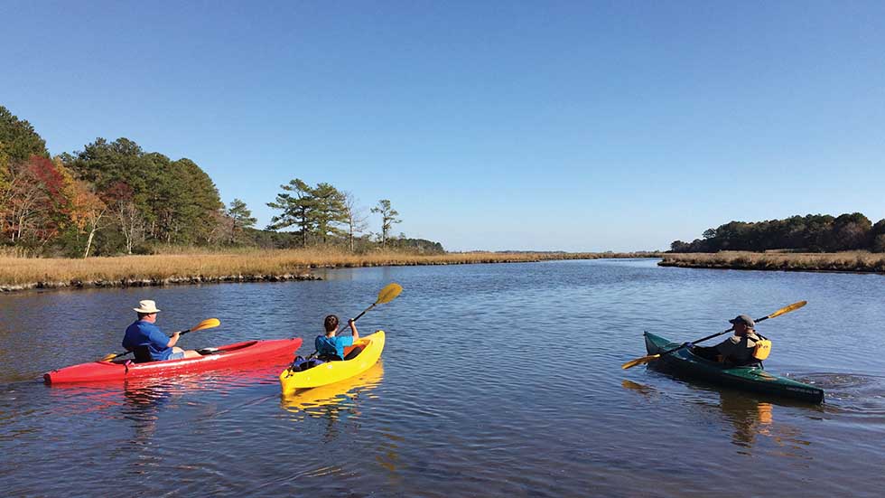
When you’re ready to get back to nature, take Route 50 West to 611 South, crossing the Verrazano Bridge (two years older than New York’s bridge of the same name) to Assateague Island, a 37-mile undeveloped barrier island. The northernmost two miles of the island make up Assateague State Park, which offers an ocean beach and bayside canoeing and kayaking.
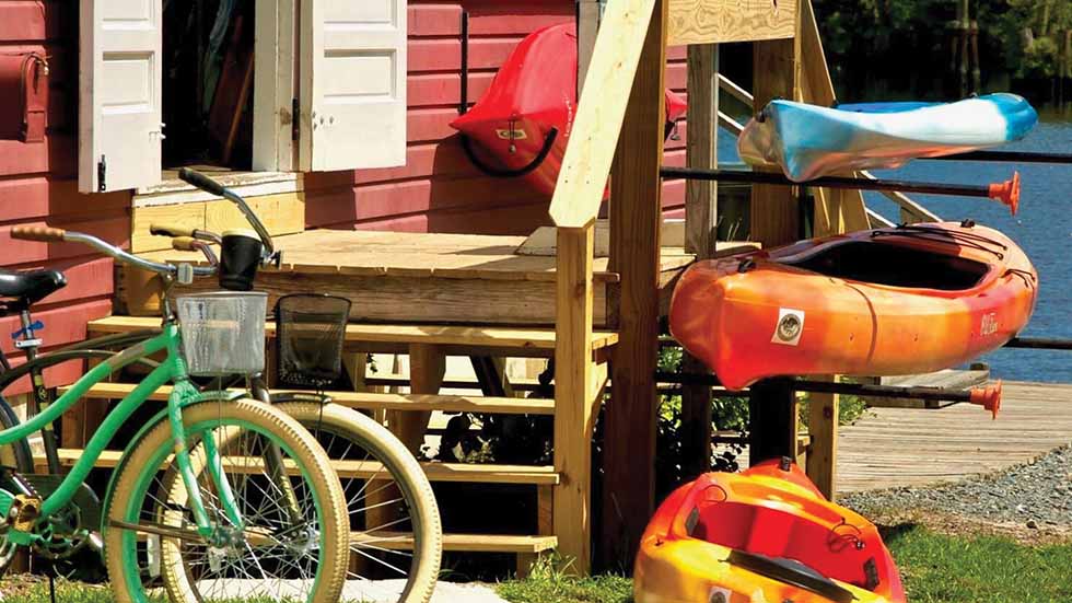
Delmarva MD Summer activities in Snow Hill. Photo credit Worcester County Tourism
Continue along the main road to Assateague Island National Seashore. Although the pavement ends fairly quickly, the national seashore extends approximately 20 miles farther south to the Virginia state line, past which the remaining 15 miles or so of the island becomes Chincoteague National Wildlife Refuge. (The only way to access the wildlife refuge is from Virginia. More on that later.)
The national seashore is noted for wildlife watching—both birds (the salt marshes are havens for resident and migratory birds on the Atlantic Flyway) and feral horses, which roam freely. If you’re lucky enough to catch sight of a horse, remember that they are wild animals, and keep your distance.
You’ll get another chance to see the horses in Virginia, but for now, retrace your route out of the park, take 611 north to Route 376 West, and turn south onto Route 113. In 15 miles, you’ll arrive at your final stop in Maryland: Snow Hill, a town of 2,000 founded in 1686 on the south bank of the Pocomoke River.
With buildings ranging from Colonial to Art Deco, the Snow Hill Historic District encompasses almost 80 percent of the town. In addition to strolling, dining, and browsing art galleries, visitors come here to canoe and kayak on the Pocomoke. Bald cypresses lining the river give the water its unique “sweet tea” color; their roots leech tannins into the water, which also act as a deterrent to mosquitoes. Rent watercraft from Pocomoke River Canoe Co., or sign up for the company’s two-hour pontoon boat cruise. Either way, you’ll get the chance to see bald cypresses that are hundreds of years old.
Wave goodbye to Maryland as you continue south on Route 113 to the Virginia line, where the route number changes again, this time to Virginia Route 13.
Delmarva VA An Antares rocket lifts off from the Wallops Flight Facility with supplies destined for the International Space Station Photo credit NASA

VIRGINIA: ROCKETS TO REFUGES
On the way to Chincoteague Island and Chincoteague National Wildlife Refuge, stop at the Visitor Center at NASA Wallop’s Flight Facility. Just a few miles south of the state line, Route 175 East leads to all three destinations.
Didn’t know Delmarva had a NASA facility? You’re not alone, despite the fact Wallops has been here since 1945. You can learn all about NASA’s primary location for research using suborbital vehicles (aircraft, scientific balloons, and sounding rockets) at the NASA Wallops Visitor Center. The location also offers unobstructed views of rocket launches, including those supplying the International Space Station. Information on upcoming rocket launches can be found online at Wallops Flight Facility or by calling 757-824-2050.
Back down on Earth, set your sights on Chincoteague Island five miles to the east. Chincoteague may be the largest city on Virginia’s narrow 70-mile-long Eastern Shore, but with a population of under 3,000, it’s still a small town. Tourists come here primarily because Chincoteague is the gateway to Virginia’s section of Assateague Island with its long unspoiled beach and 14,000-acre Chincoteague National Wildlife Refuge.
Virginia’s herd of wild horses (usually called Chincoteague ponies because of their small stature) can number more than 150, and there are numerous options for searching them out, including commercial boat tours, a bus tour by the refuge’s friends group and simply driving down the main park road.
Before leaving Chincoteague Island, stop at Island Creamery, which serves homemade ice cream in a riot of flavors. Check the menu for Rocket Fuel (chocolate ice cream with cinnamon and chili pepper), a highly appropriate toast to the region.
From here on, the route directions are easy. Retrace your steps, and get back on Virginia Route 13 South, the main road leading to the tip of the peninsula. But don’t beeline to the finish; you’ll want to visit one or more of the towns nestled along the Atlantic Coast and Chesapeake Bay.
With antique shops, art galleries, and a restored 1950 movie theater that shows first-run films and international flicks, bayside Onancock offers the sophistication of a much larger town. The town’s Saturday market is stocked with locally farmed produce and freshly harvested seafood; try oysters and clams from nearby Hog Island Bay.
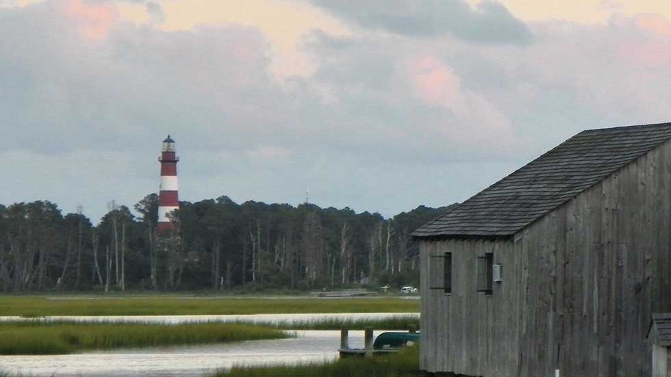
Delmarva VA Assateague Lighthouse is still active Photo credit Chincoteague Chamber of Commerce
On the ocean side, Wachapreague is a jumping-off point to the Nature Conservancy’s Virginia Coast Reserve, which comprises 14 undeveloped barrier and marsh islands—the longest coastal wilderness remaining in the Eastern U.S. Cruise through it on a 23-foot-long skiff piloted by Captain Meriwether Payne of Seaside Ecotours. She’ll point out the astonishing array of shorebirds whose names like Marbled Godwits and Short-billed Dowitchers sound as if they were purloined from a Dr. Seuss book. Sea turtles and dolphins have also been known to make their acquaintance during the journey.
Before leaving Virginia’s Eastern Shore, you have one last chance to immerse yourself in nature at the 1,123-acre Eastern Shore of Virginia National Wildlife Refuge. Delmarva’s southern tip narrows to a point between the Atlantic Ocean and the Chesapeake Bay, creating a popular stopover for migratory songbirds and raptors. More than 400 species of birds have been spotted in the refuge, along with millions of monarch butterflies. The great migration takes place in the fall, but other wildlife—including endangered loggerhead turtles, American mink, and river otter—are visible year-round.
By this point, you’ve driven down the entire Atlantic coastline of the Delmarva Peninsula. We have one parting recommendation: Cap off your road trip with a 17.6-mile extension over the mouth of the Chesapeake Bay into southeastern Virginia via the Chesapeake Bay Bridge-Tunnel.
Named “One of the Seven Engineering Wonders of the Modern World” in 1965, the Bridge-Tunnel in each direction combines two high-rise bridges, two shared underwater tunnels (anchored by four manmade islands) and multiple trestle bridges. Crossing this engineering marvel, with the Atlantic Ocean on your left and the Chesapeake Bay to your right, will thrill your inner geek and give you a final, satisfying dose of beautiful mid-Atlantic coastline.